Kshitij Goel Robotics Researcher

Communication-Efficient Planning and Mapping for Multi-Robot Exploration in Large Environments

RAL · 2019

How to efficiently communicate relevant information between robots as the robots explore a large 3D environment?

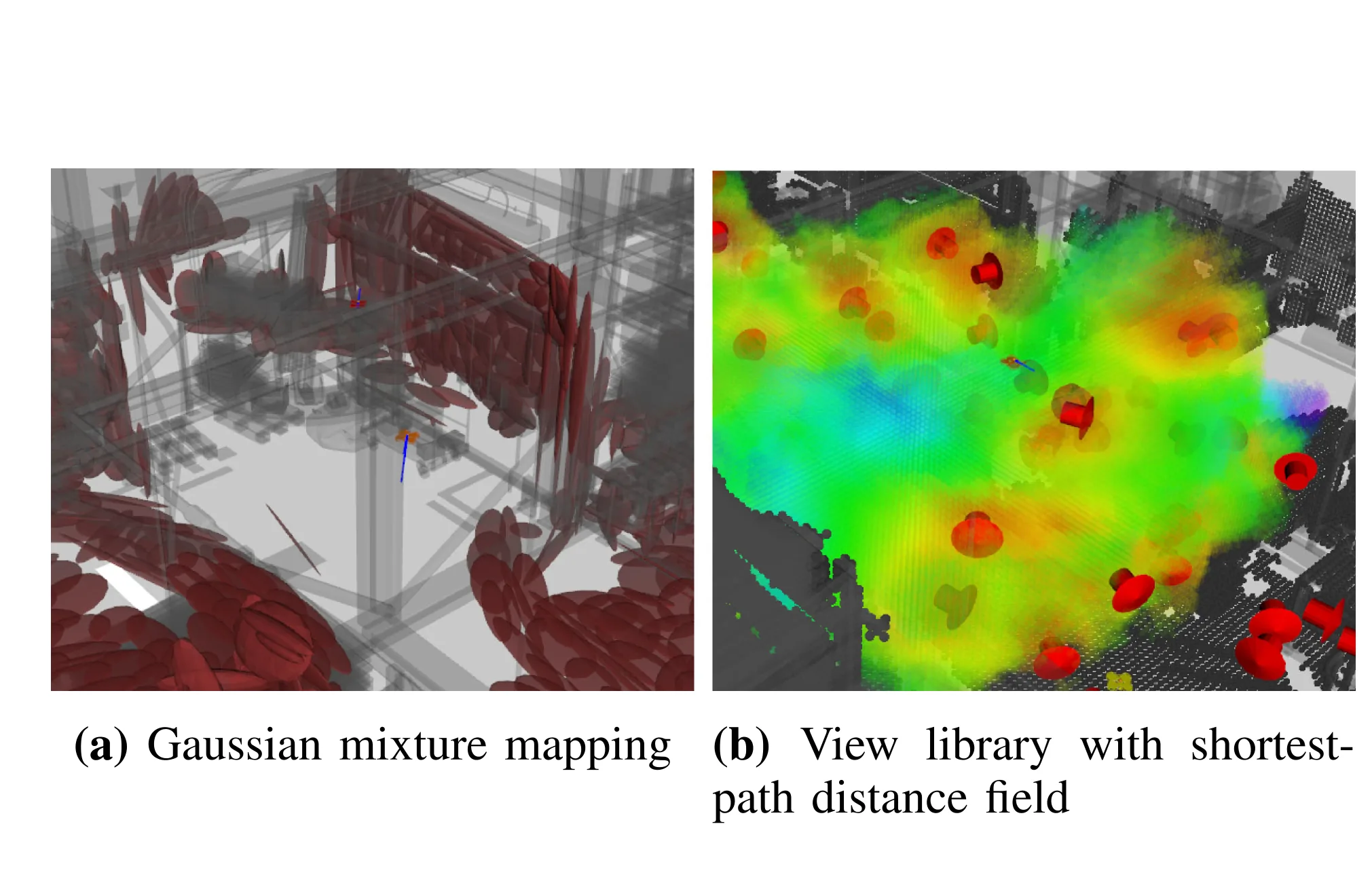
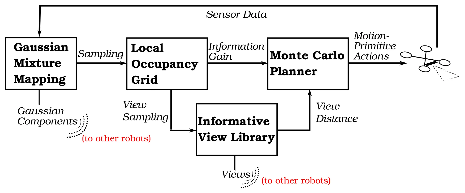
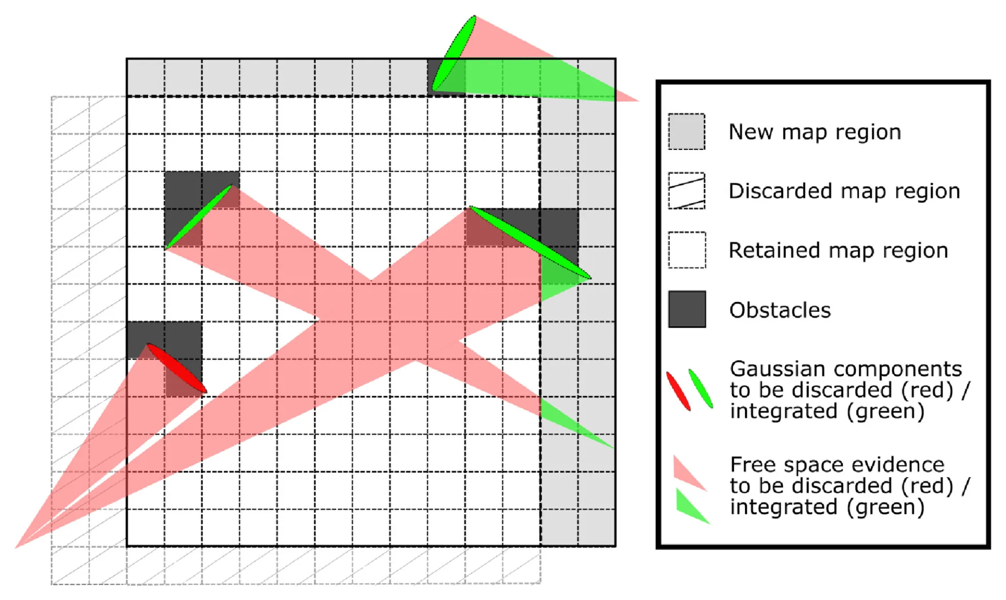
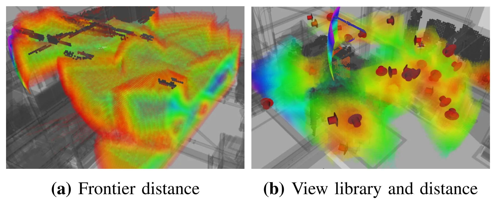
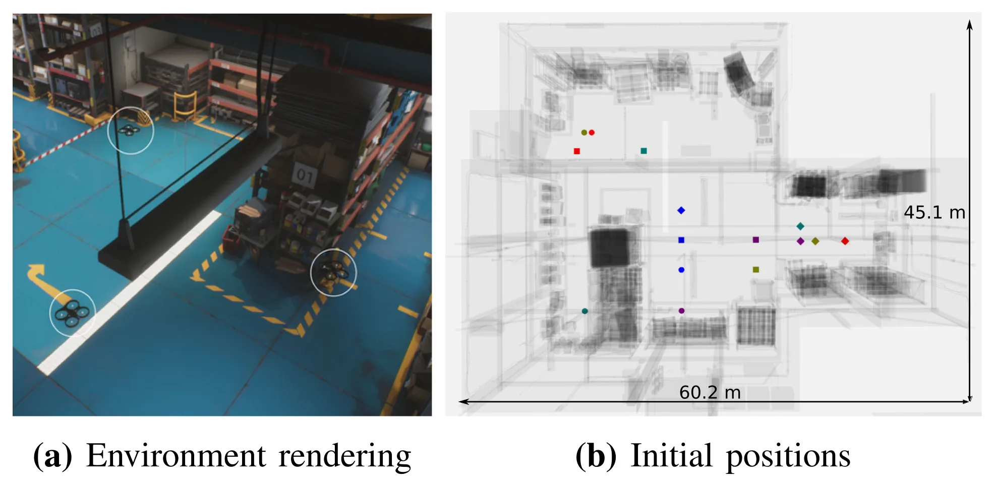
This paper addresses the following problem: How to efficiently communicate relevant information between robots as the robots explore a large 3D environment? To solve this, we propose: Use Gaussian Mixture Models (GMMs) and a sparse set of informative views to model and communicate local and global spread of occupancy information.

Figures

Method Teaser
Method Teaser In the proposed approach, lightweight data structures enable effective multi-robot exploration. (a) A Gaussian mixture model (red ellipsoids) serves as a global spatial representation of the environment geometry in the distributed mapping system. (b) A library of informative views (red arrows) represent the distribution of views of unmapped space. The receding-horizon planner then minimizes shortest-path distances (rainbow) to the views which draws the robot toward information-rich regions of the environment while the planner simultaneously maximizes information gain with respect to the partially mapped environment.
System Overview
System Overview A team of identical robots use sensor data from depth cameras to update a global Gaussian mixture model (GMM) while sharing Gaussian components. Robots then sample points from the GMM to produce a local occupancy grid for use in planning. They then sample views locally and share views with the other robots to maintain an informative view library that represents the spatial distribution of information in the state space. The Monte Carlo tree search planner seeks to maximize information gain while minimizing distances to informative views and outputs the motion-primitive actions that the robots track.
Sliding Grid Map
Sliding Grid Map Sliding grid map and resampled ray trimming. After robot motion, the hatched region becomes out of bounds and is mapped to the new region, shown in gray. Beams sampled from the GMM are intersected with the new map region to prevent double counting their contributions to occupancy probability. The trimmed portions of the resampled beams are shown in red and the portions used to update the map are shown in green.
Frontier and View Distances
Frontier and View Distances This figure examines frontier and view distances with red signifying least and blue greatest distances. (a) Frontier distance accounts for locations of unobserved parts of the map but not for the sensor model. Frontier distances are strongly influenced by frontier voxels associated with relatively uninformative camera views such as those at the top or bottom of known free space (shown n the figure) which are difficult to observe using a forward-facing camera. (b) The view library and distance directly account for camera views and expected information gain and more accurately represent how best to observe unexplored regions of the environment.
Simulation Setup
Simulation Setup (a) Three robots (circled in white) explore in the 3D warehouse environment and (b) in each of the five trials—shown in different colors—start from different initial positions in order to ensure a variety of initial conditions.
Entropy Reduction
Entropy Reduction Entropy reduction variation over time for the simulation experiments. Shaded regions show standard error.
Communication Rates
Communication Rates (Left) Communication rates for the proposed approach (Red) which uses GMMs are substantially less than if communicating novel points (Blue). Note that channel properties are assumed to be the same for each approach and accordingly, communication rate is equal to the rate of data produced across the team. (Right) View transmission requires a similar communication bandwidth to the GMM component messages.

Acknowledgments

This work was supported in part by Department of Energy (DE-EM0004067), in part by Defense Threat Reduction Agency (HDTRA1-13-0026), and industry.

BibTeX

@article{communication-efficient-planning-2019,
  title={Communication-Efficient Planning and Mapping for Multi-Robot Exploration in Large Environments},
  author={Micah Corah, Cormac O'Meadhra, Kshitij Goel, and Nathan Michael},
  journal={IEEE Robotics and Automation Letters, Apr. 2019},
  year={2019}
}